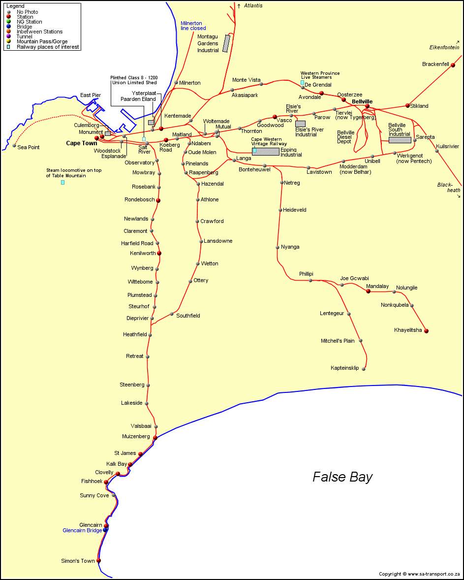
To use the map:- Coloured dots indicate photos, if there are more photos you will see the link on the hyperlink on the names (mouse over the name to see if there is a hyperlink), that will take you to the section on the page where those photos are, you will have to use your browser back button to go back to the map, legend for the coloured dots at the top left hand corner of the map.

Avondale Bellville Diesel Depot More photos from Bellville Brackenfell Cape Town carriage yards More photos from Cape Town Clovelly Fish Hoek More photos from Fish Hoek More photos from Glencairn Glencairn Kalk Bay More photos from Kalk Bay Kenilworth More photos from Kenilworth Khayelitsha Koeberg Road More photos from Koeberg Road Mandalay Monument Muizenberg More photos from Muizenberg Oosterzee Rondebosch More photos from Rondebosch Simon's Town More photos from SImon's Town St James Stikland Vasco More photos from Vasco Ysterplaat Glencairn Bridge

Back to Station Index  |  Western Cape Map